 Doug Kerr, Wikimedia, CC BY-SA 2.0
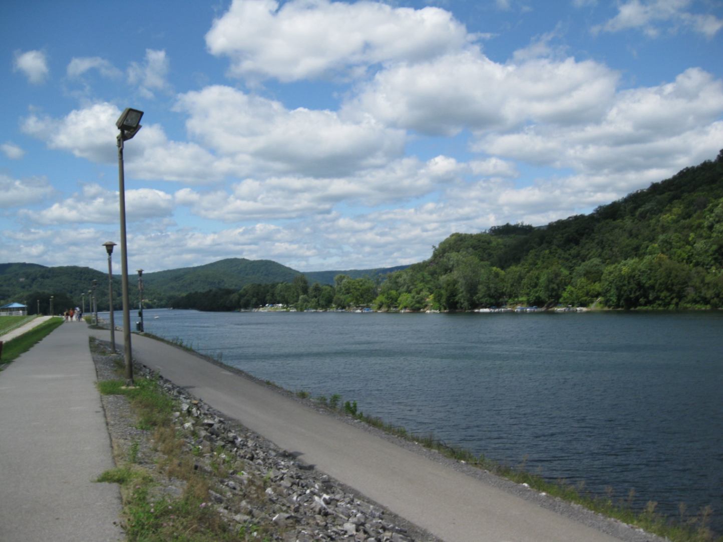
Trail development continues to grow in response to increasing demand for nonmotorized mobility options. Walking and bicycling—for commuting and recreational purposes—support social interactions, health and wellness, and economic development efforts for local communities. Economic benefits may include growth in tourism and an increase in property values for adjacent owners. Individual trail users also benefit from reduced transportation costs, compared with motorized modes.
The SEDA Council of Governments (SEDA-COG) metropolitan planning organization (MPO) oversees transportation planning for eight counties in Central Pennsylvania. The region encompasses more than 100 miles of walking, hiking, and biking trails. To understand the role that these routes play in the transportation network and to plan for them, the agency launched the SEDA-COG MPO Bicycle and Pedestrian Counts Program in 2022.
Problem
Trail authorities and planning organizations are regularly faced with making complex decisions related to trail planning, operations, and maintenance. The challenge is often understanding how, when, and where improvements should be made. Many MPOs lack a formal approach for collecting and analyzing trail data. Without a method for gauging trail demand, assumptions are made when it comes to prioritizing funding and project improvements. For example, prior to 2022, the SEDA-COG MPO did not have a formal process for collecting and assessing trail–demand data. Many of the prioritization decisions were based on information from users or were reactive, with repairs or improvements to trail conditions made after issues arose.
Overseeing the coordination of trail–demand efforts at the MPO level can allow for a streamlined approach in data collection that standardizes and enables comparison of pedestrian and bicyclist data across multiple trail facilities within a jurisdiction. In addition, prioritizing improvement areas based on trail usage and demand data at the MPO level would be especially helpful in being proactive with maintenance and future development needs.
Solution
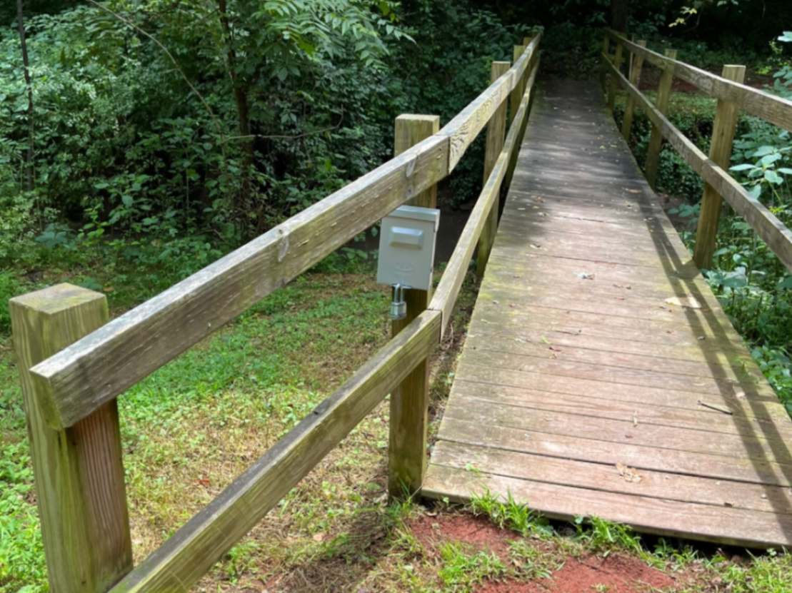
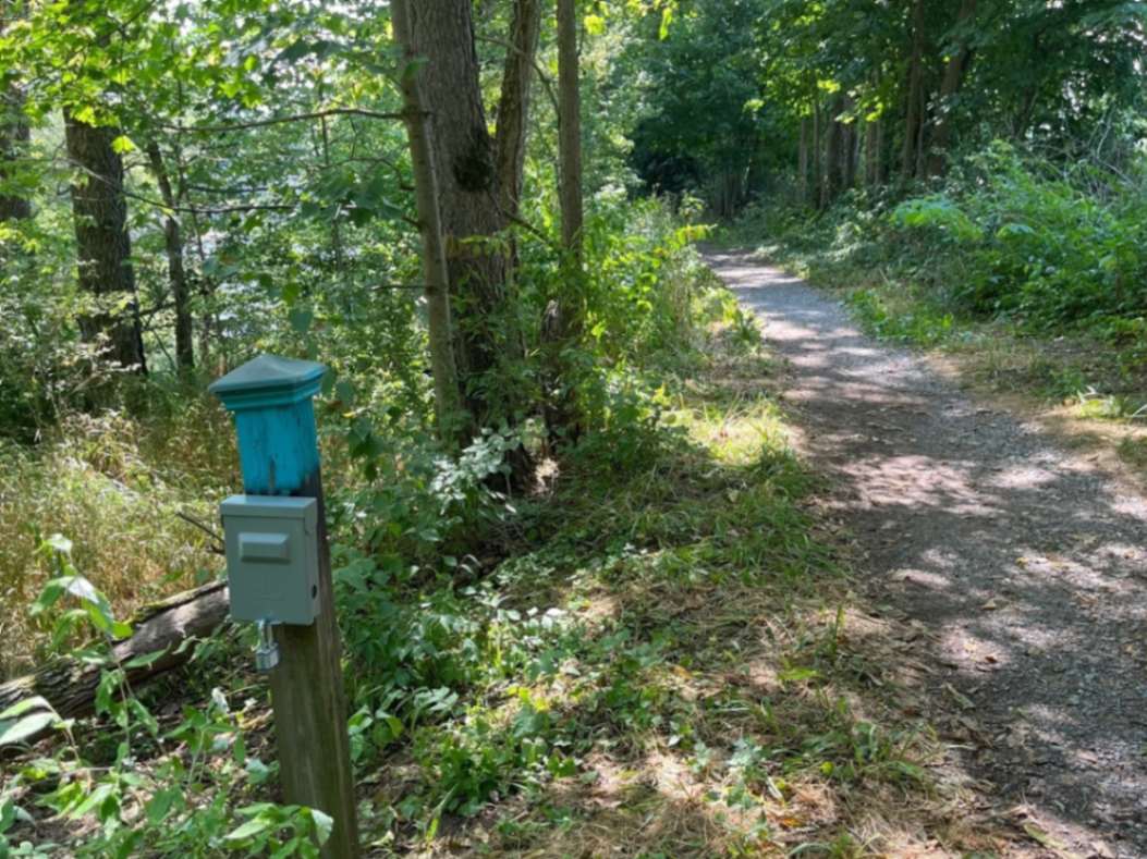
In 2022, the SEDA-COG MPO purchased six TRAFx Infrared Trail Counters (Generation 4.1) to begin the traffic estimation process on the regional trail network. TRAFx counters were selected for the study because of their quick installation, affordability, and transferability to new sites, as well as the researchers’ past experience with using this type of counter. The SEDA-COG MPO selected three trail networks—Dale’s Ridge Trail, Milton State Park, and Watsontown Towpath—within the region to conduct the preliminary cycle of its count program during 2022–2023. These trail networks were selected based on their proximity to Lewisburg-based SEDA-COG and Bucknell University staff, who were needed to perform equipment checks and manual validation counts.
 Michelle Beiler
The findings show that trail users are most likely to travel during the spring and fall seasons. Based on the collected data, users travel on the sampled trail networks the most during March–May and September–November. Future studies may include conducting research to further understand if seasonal temperature variations, along with other factors (e.g., wildfire smoke and flooding), affect trail demand within the region.
During the week, Sundays saw the highest trail demand (21.8 percent of total traffic on all three sample trail networks), followed by Saturdays (18.9 percent). In general, the three studied trail networks received less traffic on weekdays than on weekends. On average, traffic occurred the least on Fridays (10.9 percent). Overall, trail demand is highest in the late mornings and afternoons, with peak traffic occurring at 11 a.m. and between 2 and 5 p.m. Generally, users hit the trails starting at 6 a.m. It is uncommon for there to be traffic recorded through the evening to early morning, between 8 p.m. and 6 a.m. (1).
Application
The findings will inform maintenance and operations investments on the Dale’s Ridge Trail, Milton State Park, and Watsontown Towpath. Winter maintenance needs are perhaps less of a focus, given the high traffic occurring during spring and fall. In addition, these results help to downgrade lighting as a priority need, as users tend to frequent the trails during daylight hours—which corresponds with current recommendations on closing the trails at dusk. For some trails, hunting closures are required. Since the counts should be zero during those periods, the data could be useful in suggesting whether additional signage and closure notices are needed to keep users off the paths in hunting season.
 Michelle Beiler
The Merrill Linn Conservancy—a nonprofit organization that manages the Dale’s Ridge Trail—currently uses the trail-count data for three main purposes. First, it has incorporated the data into grant applications and donation requests to show the impact the conservancy is having on the local community. Second, the organization has used the information to help determine how and when to hold events on the trail. Third, the group has more information about how to target fundraising needs and also hopes to leverage the data to learn more about trail users’ needs.
Prior to the trail–demand program, the conservancy was making assumptions regarding the impact the trail was having on the community. But now, the trail–demand data have led to better decision making, such as maximizing the use of donated resources. An example of these efforts includes improvements to switchbacks on the Dale’s Ridge Trail in April 2024. The data counts from the program were used to justify the need for switchback improvements and secure grant funding from the American Rescue Plan Act of 2021 (also known as the COVID-19 Stimulus Package) and Union County, where the Dale’s Ridge Trail is located.
This first year of data collection prompted a second round of trail counts that include the Bald Eagle Valley Trail in Clinton County. The county’s planning department has been actively using the data in grant proposals to support funding requests for specific areas of improvement. For example, the planning department has used existing data gathered from the counters to apply for a local community foundation grant and intends to use yearlong data for a statewide grant application. In addition to grant applications, planners are utilizing the numbers for their county comprehensive plan.
Benefits
The SEDA-COG MPO trail–demand program is currently benefiting a number of entities, including trail authorities, the MPO, and the public.
For trail authorities, having information on the existing usage of trails within the region can lead to improved decision making related to operations and repairs, safety features, and winter maintenance. Being aware of high-priority areas and intersections with nearby pedestrian and cycling facilities can help to streamline funding resources, as well as support opportunities for trail expansions and connectivity. Additionally, exploring seasonal fluctuations and time-of-day usage can allow for more efficient funding to ensure trail availability, particularly for people using the trails for commuting purposes.
As the program continues beyond its first year, quantitative benefits—such as dollars raised through successful grant funding efforts supported by trail data or dollars saved because of targeted maintenance needs—will be assessed across the trail authorities.
For SEDA-COG, the project is strengthening the relationship between the MPO and local trail authorities. Having this strong connection is vital to supporting pedestrian and cycling mobility throughout the MPO region. Moreover, understanding usage trends and the locations where demand is high can be useful in identifying opportunities to partner and collaborate with trail authorities on seeking future trail-development grants and funding sources. These benefits help to justify the initial and ongoing costs associated with the project, such as equipment expenses—approximately $4,500 for the initial 2022–2023 installation—as well as employee time and labor.
With regard to the public, the trail–demand information creates awareness of the need for pedestrian and cycling mobility and the importance of nonmotorized mobility funding. Trail counts provide usage numbers that can be tracked over time to determine opportunities for supporting the growth of walking and cycling.


