 Nic Naylor, Utah DOT
It’s one of the most terrifying—and potentially dangerous—situations a driver can experience on the highway: driving in the dark in heavy traffic along curving mountain roads in a downpour so torrential that the lane markings disappear.
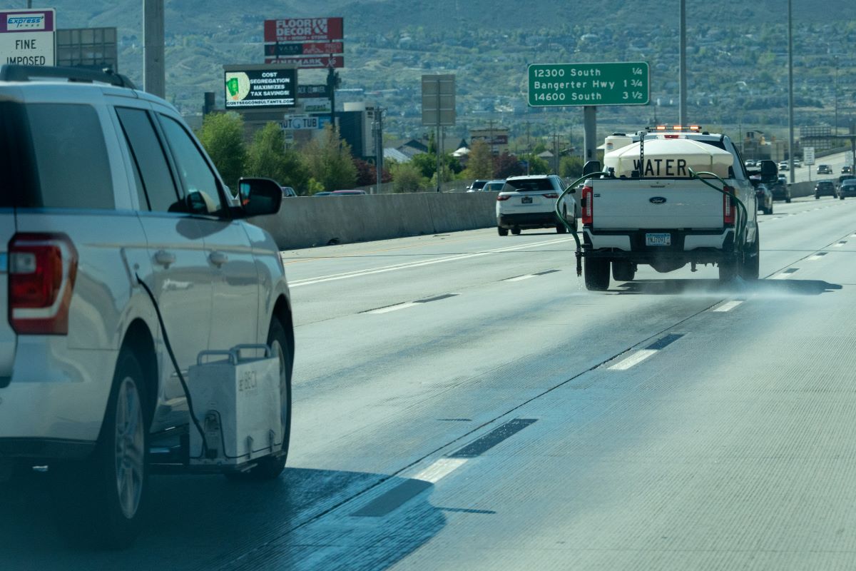
In an effort to avoid such a scenario in its state, the Utah Department of Transportation (DOT) has enhanced its method of collecting data that determine the visibility of lane markings—day or night, as well as in any weather condition. Rather than assigning crews on foot, Utah DOT is using a mobile data-collection system that deploys two vehicles and works like this: The first vehicle sprays water onto the lane marking. Following close behind, a second vehicle fitted with a retroreflectometer unit scans the lane marking to assess its visibility when wet.
What Is Retroreflectivity?
Utah DOT increases lane marking visibility by imbedding them with special glass beads or microprisms. Instead of scattering light, like typical reflective materials, these retroreflective materials bounce light in one direction.
“Anytime we can do our jobs safely and get the data we need without anyone getting hurt or impacting the public, it’s a big win,” says Abdul Wakil, a Utah DOT maintenance asset engineer. “Not only are we helping to keep routes safe and efficient in the present, but we’re also looking for innovative ways to improve [drivers’] travel experience in the future—while keeping our crews safe.”
The previous method involved crews pacing slowly over highway lane markings with a hand-held retroreflectometer, scanning them with lasers and collecting data. This process required the Utah Highway Patrol and Utah DOT’s Incident Management Team to install protective buffers between work crews and traffic—a time-consuming, costly measure that posed risks for drivers.
Five stretches along southbound I-15 between South Salt Lake City and Draper, Utah, have been designated as testing zones. Data are being used to support the installation of wet-reflective tape, which increases visibility in rainy conditions. Data are also being shared with companies and partners to improve their products, which are used on state roads.
This article is based on Utah Department of Transportation press releases on January 9 and May 2, 2025.


